


Waterfront Maps
Moorings and Slips Available
-

Mooring Field
Email operations@smsc.ca or call (902) 823-1089 and wait for confirmation before landing your vessel on a mooring. Moorings may be assigned to an existing renter, some moorings are under repair, and moorings have different displacement ratings. The mooring field is organized in a grid pattern. Depths are safe for all vessels under 10-foot draft.
Mooring field tenants must use the Tender Dock marked in blue on the Waterfront map to store their tenders.
Moorings designated HV1, HV2 and HV3 on the map are for heavy vessels with a displacement up to 40,000 lbs. The white buoys for these three moorings are currently unmarked. (Map updated 2025-07-13)
-
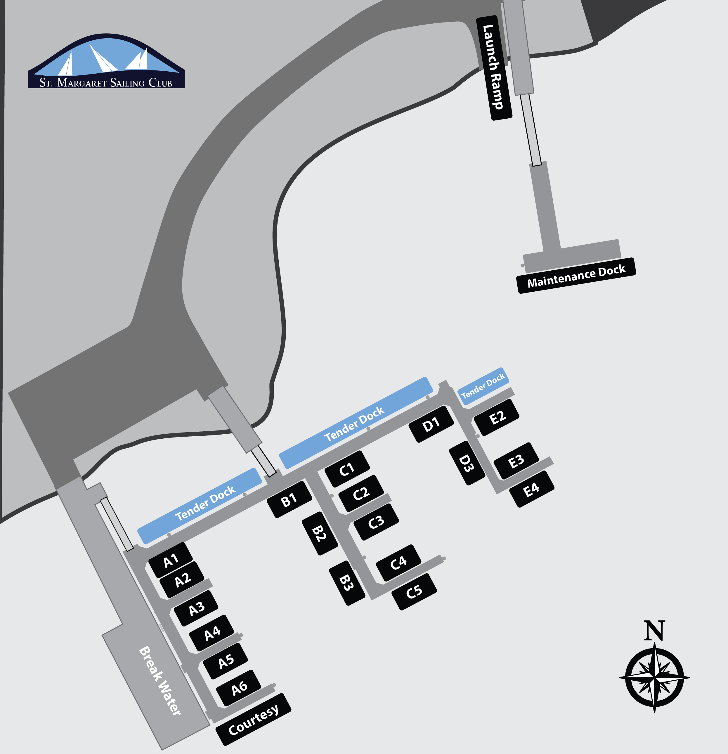
Waterfront
The slips on the waterfront provide access to 30 amp power and fresh water. All slips are typically rented to seasonal renters. Slips closest to the Tender Dock are limited to shallow draft vessels. You may use the Courtesy Dock for momentary loading and unloading. The Maintenance Dock is ideal for mooring field users to do maintenance on their vessel, or for loading and unloading. The West end of the maintenance dock shallows to about 5 feet at low tide. Mooring field tenants must use the designated Tender Dock highlighted in Blue to store their tenders. If you’ve rented a slip, then you may keep your tender next to your vessel. Due to high demand, visitors are encouraged to reserve in advance by sending an email to operations@smsc.ca.(Map updated 2025-07-13)